Inhabiting Antiquities in Ottoman Bodrum: Reconstructing a Demolished Neighborhood
A Bodrum neighborhood was built from the ruins of the ancient Mausoleum of Halikarnassos on Anatolia’s southwestern coast.
A Bodrum neighborhood was built from the ruins of the ancient Mausoleum of Halikarnassos on Anatolia’s southwestern coast.
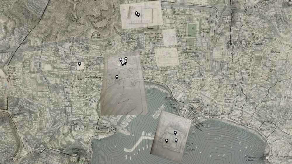
In Ottoman Bodrum, on the southwestern coast of Anatolia, there was a neighborhood built out of the ruins of a wonder of the ancient world, the Mausoleum of Halikarnassos. Marble lions decorated walls, ancient arches adorned doorways, and chiseled reliefs were part of the rhythms of the day-to-day. In the mid-nineteenth century, residents of this neighborhood were mostly elderly, and most refused to sell their houses to British archaeological excavators. In response, the British used underhanded tactics to force the purchase of the houses for cheap by digging tunnels underneath them, excavating moats around them, ruining quality of life and the value of the land. They levelled every house they acquired to the ground and removed all the artifacts they found to the British Museum. Most scholarship focuses on the British excavators, but I aim to restore and center the perspectives of the Ottoman residents before, during, and after the excavation. Reading against the grain of British sources can only get one so far; GIS reconstruction of the neighborhood topography can provide a much wider insight into the Ottoman community. This project consisted first of georectifying maps of Bodrum from the excavation accounts. Across the topography of these overlapping maps lie pop-outs of illustrations that include the neighborhood’s residential buildings and the perspective from which they were taken to aid in visualization of the demolished neighborhood. Finally, the houses demolished as part of the British excavation are outlined and returned to the landscape.
Graduate Fellowship